Page 73 - Dark Shades of Istria
P. 73
5.1 Region of Istria: A Political Geography Perspective
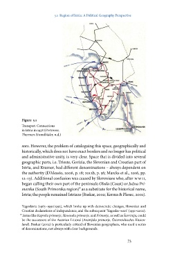
Figure 5.1
Transport Connections
in Istria in 1938 (Portorose,
Thermen-Strandbäder, n.d.)
sors. However, the problem of cataloguing this space, geographically and
historically, which does not have exact borders and no longer has political
and administrative unity, is very clear. Space that is divided into several
geographic parts, i.e. Trieste, Gorizia, the Slovenian and Croatian part of
Istria, and Kvarner, had different denominations – always dependent on
the authority (D’Alessio, 2006, p. 18; 2012b, p. 56; Marcks et al., 2016, pp.
12–13). Additional confusion was caused by Slovenians who, after wwi i,
began calling their own part of the peninsula Obala (Coast) or Južna Pri-
morska (South Primorska region)⁹ as a substitute for the historical name,
Istria; the people remained Istrians (Baskar, 2002; Kerma & Plesec, 2001).
Yugoslavia (1963–1991/1992), which broke up with democratic changes, Slovenian and
Croatian declarations of independence, and the subsequent ‘Yugoslav wars’ (1991–2001).
⁹ Terms like Koprsko primorje, Slovensko primorje, and Primorje, as well as Šavrinija, could
be the successors of the Austrian Littoral (Avstrijsko primorje, Österreichisches Küsten-
land). Baskar (2002) is particularly critical of Slovenian geographers, who used a series
of denominations, not always with clear backgrounds.
73